
Preview
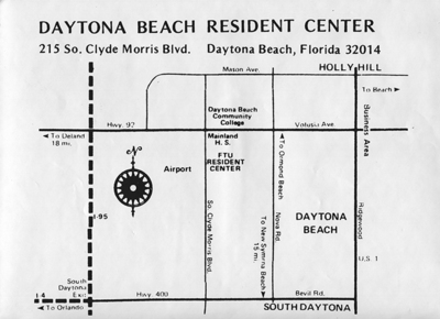
Photo Description
A map of how to get to the UCF (then FTU) Daytona Center. It shows connections to Hwy. 92, I-4, and US 1
Keywords
Daytona Higher Education Center
Subject
Maps--Florida--Photographic prints; Universities & colleges--Florida--Daytona Beach; University of Central Florida--Buildings; Daytona Beach Community College--Buildings;
Date Original
1-1-1970
Contributing Unit
Unknown
Number of Images
1
Format
tiff
Size Original
25 cm. x 18 cm.
Document Type
Photograph
Coverage-Temporal
20th century
Place
Orlando (Fla.)
Digital Reproduction Specifications
Jpeg2000 images were derived from no less than 400 dpi tiff images
Date Digital
2011-05
Date Contributed
August 2017
Identifier
DP0010951
Type
image
Rights
All rights to images are held by the respective holding institution. This image is posted publicly for non-profit educational uses, excluding printed publication. For permission to reproduce images and/or for copyright information contact Special Collections and University Archives, University of Central Florida Libraries, (407) 823-2576 http://library.ucf.edu/SpecialCollections/
File Location
V:\Archives\University Photograph Collection\II Buildings, 1966-1995\Daytona\Master
Collection
University Photograph Collection
Recommended Citation
"Daytona Beach FTU Resident Center map" (1970). University Photograph Collection. Image 450.
https://stars.library.ucf.edu/univphotocollection/450
Keywords
Daytona Higher Education Center
Accessibility Statement
This item was created or digitized prior to April 24, 2027, or is a reproduction of legacy media created before that date. It is preserved in its original, unmodified state specifically for research, reference, or historical recordkeeping. In accordance with the ADA Title II Final Rule, the University Libraries provides accessible versions of archival materials upon request. To request an accommodation for this item, please submit an accessibility request form.