

Images of Central Florida
Preview
Contributors
Colton, J.H.; Hutchins, Joseph.; Lewis and Clark Explorer Maps, ltd.
Description
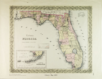
Colton's 1859 map of Florida, as a facisimile reproduced "from the orginal with Colton's revisions through 1859.and Facisimile created by Lewis and Clark Explorer Maps, ltd, c1967. Map contains inset plan of the Florida Keys. Map scale [ca. 1:2,050,000].
Date
1859
Subjects
Florida -- Maps -- Facisimile.; Florida Keys (Fla.) -- Maps -- Facisimile.; Florida -- Historical geography -- Maps.
Subject-Topic
Maps
Coverage-Spatial
Florida; Florida Keys (Fla.)
Coverage-Temporal
19th century
Side of Image
Front of Postcard
Repository
Rollins College
Repository Collection
Archives and Special Collections
Identifier
DP0004229; 5479301
Size of Original Image
38 x 47 cm.
Rights Statement
All rights to images are held by the respective holding institution. This image is posted publicly for non-profit educational uses, excluding printed publication. To purchase copies of images and/or for copyright information contact the respective holding institution.
Digital Publisher
Electronically reproduced by the Digital Services unit of the University of Central Florida Libraries, Orlando, 2005.
Digital Reproduction Specifications
This image was derived from an uncompressed TIFF image scanned at a minimum of 400 dpi.
Recommended Citation
Colton, George Woolworth, "Colton's Florida 1" (1859). Images of Central Florida. 135.
https://stars.library.ucf.edu/cfm-images/135
Accessibility Statement
This item was created or digitized prior to April 24, 2027, or is a reproduction of legacy media created before that date. It is preserved in its original, unmodified state specifically for research, reference, or historical recordkeeping. In accordance with the ADA Title II Final Rule, the University Libraries provides accessible versions of archival materials upon request. To request an accommodation for this item, please submit an accessibility request form.