

Images of Central Florida
Preview
Description
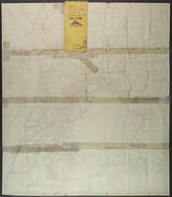
Map of the Plant system of railway steamer and steamship lines and connections, includes inset maps of southern Florida and Cuba. Map is a gift of Mr. John McClellan, March 15, 1978. Map also denotes forts and counties. Attached on the back of the map is the front cover of the map with images of maps, inscribed in pen: gift of Mr. John McClellan, 2 Orchard St., Andover, Mass. 01810.
Date
1893
Subjects
Railroads -- Florida -- Maps; Railroads -- Georgia -- Maps.; Railroads -- Alabama -- Maps.; Steamboat lines -- Florida -- Maps.; Steamboat lines -- Georgia -- Maps.; Steamboat lines -- Caribbean Sea -- Maps.; Florida -- Maps.; Georgia -- Maps.; Cuba -- Maps.; Plant System of Railways -- Maps.; Forts -- Florida -- Maps.; Florida -- Administrative and political divisions -- Maps.; Florida -- Historical geography -- Maps.
Subject-Topic
Maps
Coverage-Spatial
Florida; Georgia; Alabama; Cuba
Coverage-Temporal
19th century
Number of Images
2 images
Side of Image
Back of Postcard
Repository
Rollins College
Repository Collection
Archives and Special Collections
Identifier
DP0003867; 57363061
Size of Original Image
57 x 49 cm.
Rights Statement
All rights to images are held by the respective holding institution. This image is posted publicly for non-profit educational uses, excluding printed publication. To purchase copies of images and/or for copyright information contact the respective holding institution.
Digital Publisher
Electronically reproduced by the Digital Services unit of the University of Central Florida Libraries, Orlando, 2005.
Digital Reproduction Specifications
This image was derived from an uncompressed TIFF image scanned at a minimum of 400 dpi.
Recommended Citation
Matthews-Northrup Company., "Map of the Plant system of railway steamer and steamship lines and connections." (1893). Images of Central Florida. 2392.
https://stars.library.ucf.edu/cfm-images/2392
Accessibility Statement
This item was created or digitized prior to April 24, 2027, or is a reproduction of legacy media created before that date. It is preserved in its original, unmodified state specifically for research, reference, or historical recordkeeping. In accordance with the ADA Title II Final Rule, the University Libraries provides accessible versions of archival materials upon request. To request an accommodation for this item, please submit an accessibility request form.