

Images of Central Florida
Preview
Photographer
Unknown
Keywords
Aerial View; Roadmap
Description
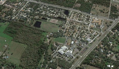
Various aerial views and roadmaps showing St. Luke's property, the Lutheran Haven and surrounding areas, from 2013-2015
Date
2013-2015
Coverage-Spatial
Seminole County, Fla.
Side of Image
Front of Postcard
Repository
St. Luke's Lutheran Church and School; DSpace at St. Luke's
Repository Collection
Archives of St. Luke's Lutheran Church;
Identifier
DP0019413
Rights Statement
All rights to images are held by the respective holding institution. This image is posted publicly for non-profit educational uses, excluding printed publication. For permission to reproduce images and/or for copyright information contact St. Luke's Lutheran Church at 2021 W SR 426, Oviedo, FL 32765 or (407) 365-3408.
Digital Publisher
St. Luke's Lutheran Church, Oviedo, Fla.
Digital Reproduction Specifications
Jpeg2000 images were derived from previously scanned jpeg images.
Disciplines
Photography
Recommended Citation
"Aerial Views and other maps of Slavia 2013-2015" (2015). Images of Central Florida. 4983.
https://stars.library.ucf.edu/cfm-images/4983
Keywords
Aerial View; Roadmap
Accessibility Statement
This item was created or digitized prior to April 24, 2027, or is a reproduction of legacy media created before that date. It is preserved in its original, unmodified state specifically for research, reference, or historical recordkeeping. In accordance with the ADA Title II Final Rule, the University Libraries provides accessible versions of archival materials upon request. To request an accommodation for this item, please submit an accessibility request form.