

Images of Central Florida
Preview
Contributors
Secretary Publicity Department.; White, E.E.; Rollins Press.
Description
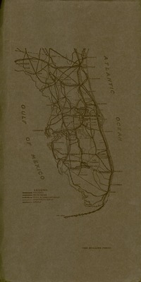
Map of Winter Park (Fla.) termed "The City of Homes. Map contains town statistics and land subdivisions, and lakes. Original scale 1 inch equals 200 feet. Contributors on the map include: E.E. White, Civil Engineer, and drawn B.D. Bastcam (sp?). Compiled by Secretary Publicity Department, Winter Park Chamber of Commerce and printed by Rollins Press.
Date
1925
Subjects
Winter Park (Fla.) -- Maps.; Statistics -- Florida -- Winter Park -- Maps.; Land subdivision -- Florida -- Winter Park -- Photographs.; Florida -- Maps.
Subject-Topic
Maps
Number of Images
2 images
Side of Image
Back of Postcard
Repository
Rollins College
Repository Collection
Archives and Special Collections
Identifier
DP0004868
Rights Statement
All rights to images are held by the respective holding institution. This image is posted publicly for non-profit educational uses, excluding printed publication. To purchase copies of images and/or for copyright information contact the respective holding institution.
Digital Publisher
Electronically reproduced by the Digital Services unit of the University of Central Florida Libraries, Orlando, 2005.
Digital Reproduction Specifications
This image was derived from an uncompressed TIFF image scanned at a minimum of 400 dpi.
Recommended Citation
Winter Park Chamber of Commerce., "Map of "The City of Homes," Winter Park, Florida." (1925). Images of Central Florida. 2368.
https://stars.library.ucf.edu/cfm-images/2368
Accessibility Statement
This item was created or digitized prior to April 24, 2027, or is a reproduction of legacy media created before that date. It is preserved in its original, unmodified state specifically for research, reference, or historical recordkeeping. In accordance with the ADA Title II Final Rule, the University Libraries provides accessible versions of archival materials upon request. To request an accommodation for this item, please submit an accessibility request form.