

Images of Central Florida
Preview
Description
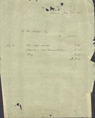
C.R. Switzer property map for his land in Orange County (Fla.) along with a letter to C.R. Switzer about the map of his property in Winter Park (Fla.) written July 31, 1895. Map is signed by J.O. Fries Co-surveyor. Map Scale: 1 inch and 132 feet. Hand written text on map describing the layout of the land by the surveyor. (A chain is a unit of measure used by surveyors: 1 chain and 66 feet.)
Date
1895-07
Subjects
Property -- Florida -- Winter Park -- Maps.; Switzer, C.R. -- Correspondence.
Subject-Personal Names
Switzer, C.R.
Coverage-Spatial
Winter Park (Fla.)
Coverage-Temporal
19th century
Number of Images
2 images
Side of Image
Back of Postcard
Repository
Rollins College
Repository Collection
Archives and Special Collections
Identifier
DP0004885
Size of Original Image
58 x 55 cm. (map); 25 x 20 cm. (letter)
Rights Statement
All rights to images are held by the respective holding institution. This image is posted publicly for non-profit educational uses, excluding printed publication. To purchase copies of images and/or for copyright information contact the respective holding institution.
Digital Publisher
Electronically reproduced by the Digital Services unit of the University of Central Florida Libraries, Orlando, 2005.
Digital Reproduction Specifications
This image was derived from an uncompressed TIFF image scanned at a minimum of 400 dpi.
Recommended Citation
Fries, J. O., "Map and description of C. R. Switzer property in Winter Park, Fla." (1895). Images of Central Florida. 2382.
https://stars.library.ucf.edu/cfm-images/2382
Accessibility Statement
This item was created or digitized prior to April 24, 2027, or is a reproduction of legacy media created before that date. It is preserved in its original, unmodified state specifically for research, reference, or historical recordkeeping. In accordance with the ADA Title II Final Rule, the University Libraries provides accessible versions of archival materials upon request. To request an accommodation for this item, please submit an accessibility request form.